THE 300 NAUTICAL MILES ZONE
The 300 nautical miles zone potentially includes the West Indies Islands as far to the South as St. Lucia (B.W.I) (and Grenada?), Turk Island to the North and The Republic of Dominica and Haiti to the West. The postal rate for letters within 300 nautical miles distance was 5 cents as compared to the 8 cents foreign letter rate.
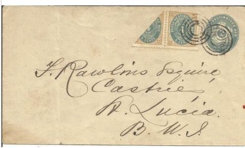
This unique cover was destined for St. Lucia - B.W.I.. It shows the letter box St. Thomas 4 rings cancels as it went from Christiansted to St. Thomas and then to St. Lucia. The bisect was not cancelled as 5 cents postage was sufficient to pay for letters travelling within 300 nautical miles (in this case counting the distance between the origin town Christiansted to St. Lucia).
Backstamped St. Thomas March 9 and Castries St. Lucia March 12. Also stamped with a 'C' showing the Christiansted origin.
The 300 nautical miles zone:
The cover shown above went by ship (Vigilant) to St. Thomas from which it received the 4 rings cancels and backstamp St. Thomas March 9 1903. From St. It was then shipped to Castries St. Lucia at which it received the backstamp Castries St. Lucia March 12.
The distance between St Thomas and Castries St. Lucia is approx 636 km which equals 343 Nautical Miles.
The distance between Christiansted to Castries St. Lucia is approx. 575 km which is 311 nautical miles.
The sender was technically correct in franking the cover 8 cents as the actual distance exceeded the 300 nautical miles zone by 11 nautical miles – but the St. Thomas Post Office did not cancel the bisect as they accepted the distance between Christiansted – Castries St. Lucia to be within the 300 nautical miles from Christiansted and the postage to be 5 cents accordingly.
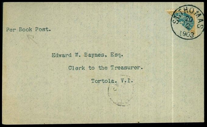
Cover sent per Book Post at the postage rate 2 cents within the 300 nautical miles zone. Cancelled St Thomas February 20 1903 and destined for Tortola. Backstamped Tortola Fe 21 03. The distance from St. Thomas to Tortola is around 16 nautical miles.
Del siden


